
.jpeg)
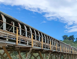
Comprehensive topography and hydro-oceanography solutions, delivering high-accuracy mapping for mining, infrastructure, and environmental projects.
At Exsa Internasional, we deliver high-accuracy survey and mapping services to support infrastructure development, engineering design, and environmental planning. Our work spans both terrestrial and marine environments, ensuring comprehensive data coverage for every stage of your project—from feasibility study to final construction. We are committed to providing precise and reliable spatial information that serves as the foundation for smarter, safer, and more sustainable decisions.
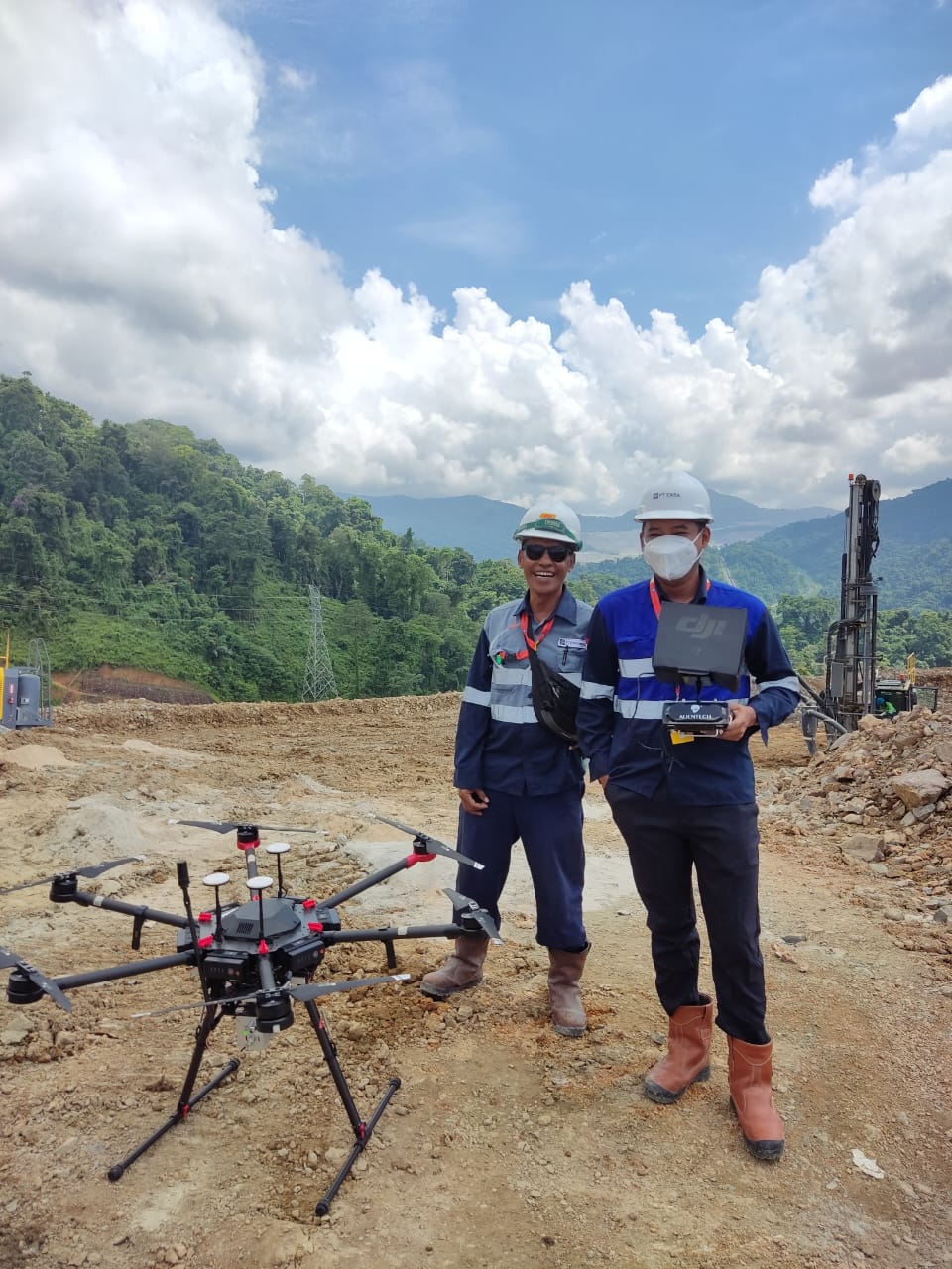
Our expertise includes a wide range of geospatial technologies and techniques such as topographic surveys, aerial photogrammetry, UAV-based LiDAR mapping, hydrographic and bathymetric surveys, as well as metocean data acquisition. Each method is selected and executed based on project-specific requirements, ensuring data accuracy, consistency, and compatibility with engineering and planning standards.
From establishing high-precision control networks and monitoring structural movements to generating detailed 3D digital terrain models and orthophotos, we provide integrated solutions that combine advanced equipment with experienced personnel. Whether for land development, coastal infrastructure, energy, mining, or transportation projects, Exsa stands as a trusted partner in delivering survey excellence.
.jpeg)
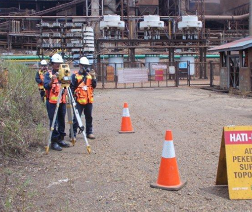
We begin with a thorough understanding of project requirements, site conditions, and mapping objectives. This allows us to select the most suitable survey methods—whether terrestrial, aerial, or marine—and define control frameworks that ensure spatial accuracy.

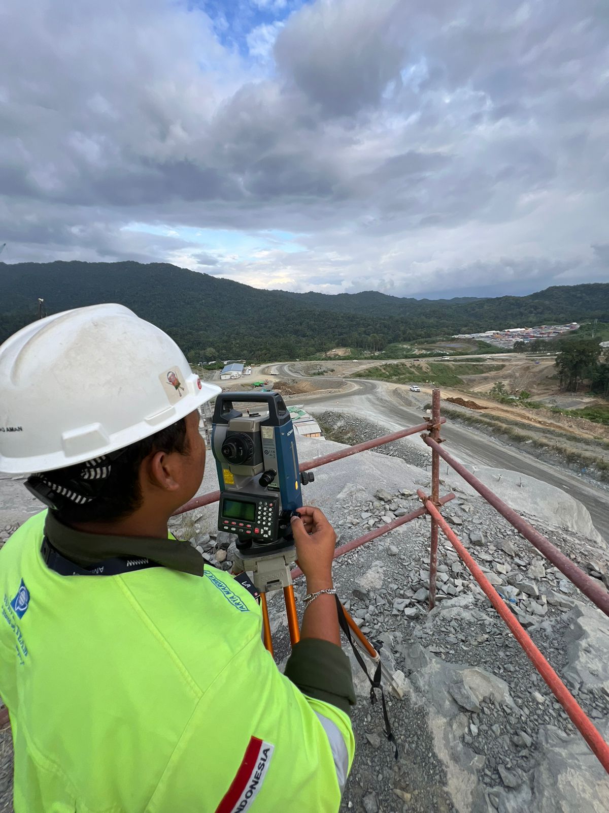
Our experienced survey teams operate advanced equipment such as Total Stations, GNSS receivers, UAV LiDAR, multibeam echosounders, and terrestrial laser scanners. Fieldwork is executed with strict quality control procedures to minimize error and maximize data integrity.

All collected data undergoes detailed post-processing using industry-standard software to ensure consistency, accuracy, and compatibility with project specifications. Final outputs include validated maps, 3D models, and spatial datasets ready for engineering, planning, or construction use.
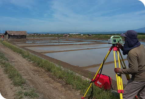
From land-based topographic mapping to hydrographic and geophysical surveys, we provide full-spectrum solutions.

Benchmark - Control Survey (ETS, DGPS, Precise Level)
Boundary & Terrestrial Topographic Mapping
3D Digital Mapping & Terrestrial Laser Scanning (TLS)
Aerial Photogrammetry & LiDAR (Drone & Airborne)
Construction Monitoring (Verticality, Settlement, Setting Out)

Lorem ipsum dolor sit amet, consectetur adipiscing elit, sed do eiusmod tempor incididunt ut labore et dolore magna aliqua. Ut enim ad minim veniam, quis nostrud exercitation ullamco laboris nisi ut aliquip ex ea commodo consequat. Duis aute irure dolor in reprehenderit in voluptate velit esse cillum dolore eu fugiat nulla pariatur.
Lorem ipsum dolor sit amet, consectetur adipiscing elit, sed do eiusmod tempor incididunt ut labore et dolore magna aliqua. Ut enim ad minim veniam, quis nostrud exercitation ullamco laboris nisi ut aliquip ex ea commodo consequat. Duis aute irure dolor in reprehenderit in voluptate velit esse cillum dolore eu fugiat nulla pariatur.
Lorem ipsum dolor sit amet, consectetur adipiscing elit, sed do eiusmod tempor incididunt ut labore et dolore magna aliqua. Ut enim ad minim veniam, quis nostrud exercitation ullamco laboris nisi ut aliquip ex ea commodo consequat. Duis aute irure dolor in reprehenderit in voluptate velit esse cillum dolore eu fugiat nulla pariatur.
Hydrographic Survey (Bathymetry – Singlebeam & Multibeam)
Geophysical Survey (Sub-bottom Profiler, Side Scan Sonar, Magnetometer)
Metocean Data Collection (Waves, Current, Wind, Tides, Meteorology)
Sediment & Water Quality Analysis (Temperature, Salinity, Transport Studies)
Lorem ipsum dolor sit amet, consectetur adipiscing elit, sed do eiusmod tempor incididunt ut labore et dolore magna aliqua. Ut enim ad minim veniam, quis nostrud exercitation ullamco laboris nisi ut aliquip ex ea commodo consequat. Duis aute irure dolor in reprehenderit in voluptate velit esse cillum dolore eu fugiat nulla pariatur.
Lorem ipsum dolor sit amet, consectetur adipiscing elit, sed do eiusmod tempor incididunt ut labore et dolore magna aliqua. Ut enim ad minim veniam, quis nostrud exercitation ullamco laboris nisi ut aliquip ex ea commodo consequat. Duis aute irure dolor in reprehenderit in voluptate velit esse cillum dolore eu fugiat nulla pariatur.
Lorem ipsum dolor sit amet, consectetur adipiscing elit, sed do eiusmod tempor incididunt ut labore et dolore magna aliqua. Ut enim ad minim veniam, quis nostrud exercitation ullamco laboris nisi ut aliquip ex ea commodo consequat. Duis aute irure dolor in reprehenderit in voluptate velit esse cillum dolore eu fugiat nulla pariatur.
From digital elevation models to detailed bathymetric maps, our expertise delivers exceptional accuracy.


“Lorem ipsum dolor sit amet, consectetur adipiscing elit, sed do eiusmod tempor incididunt ut labore et dolore magna aliqua. Ut enim ad minim veniam, quis nostrud exercitation ullamco laboris nisi ut aliquip ex ea commodo consequat. Duis aute irure dolor in reprehenderit in voluptate velit esse cillum dolore eu fugiat nulla pariatur.”

“Lorem ipsum dolor sit amet, consectetur adipiscing elit, sed do eiusmod tempor incididunt ut labore et dolore magna aliqua. Ut enim ad minim veniam, quis nostrud exercitation ullamco laboris nisi ut aliquip ex ea commodo consequat. Duis aute irure dolor in reprehenderit in voluptate velit esse cillum dolore eu fugiat nulla pariatur.”

“Lorem ipsum dolor sit amet, consectetur adipiscing elit, sed do eiusmod tempor incididunt ut labore et dolore magna aliqua. Ut enim ad minim veniam, quis nostrud exercitation ullamco laboris nisi ut aliquip ex ea commodo consequat. Duis aute irure dolor in reprehenderit in voluptate velit esse cillum dolore eu fugiat nulla pariatur.”

“Lorem ipsum dolor sit amet, consectetur adipiscing elit, sed do eiusmod tempor incididunt ut labore et dolore magna aliqua. Ut enim ad minim veniam, quis nostrud exercitation ullamco laboris nisi ut aliquip ex ea commodo consequat. Duis aute irure dolor in reprehenderit in voluptate velit esse cillum dolore eu fugiat nulla pariatur.”
Watch how we collect, process, and transform survey data into actionable insights.
Fill out the form to connect with our experts and explore the best solutions for your project or business

