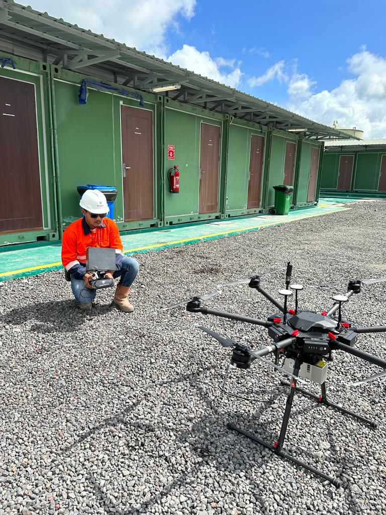
Terrestrial Laser Scanning
Terrestrial laser survey employs ground-based laser scanning to gather accurate 3D data of surfaces, aiding in mapping and modeling.

Discover how our expertise transforms ideas into reality—exploring groundbreaking projects that shape industries and communities.
A closer look at our impact—watch how we bring visions to life through cutting-edge technology and precision engineering.

Terrestrial laser survey employs ground-based laser scanning to gather accurate 3D data of surfaces, aiding in mapping and modeling.
ADCP surveys measure current velocity, flow direction, and discharge for accurate hydrodynamic and marine analysis.
DGPS LiDAR survey integrates differential GPS with laser scanning to produce accurate, geo-referenced, high-resolution 3D terrain models.

Topo survey maps land surface features and elevations to support engineering design, planning, and construction.
.jpeg)
A sub-bottom profiler is a marine geophysical tool that uses sound waves to image underwater sediment layers and geological structures.

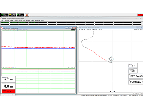
SBES measures water depth using a single acoustic beam, ideal for shallow, narrow, or inland surveys.
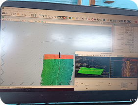
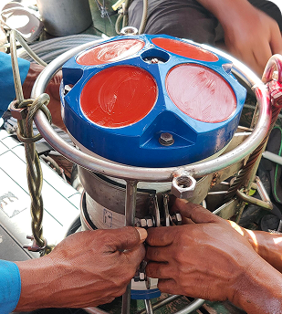
A multibeam survey utilizes sonar to create detailed seafloor maps.
Marine magnetometer maps underwater anomalies.

Side scan sonar survey captures detailed underwater images.

.png)
Pressuremeter Test measures in-situ soil deformability and strength by expanding cylindrical probe, providing parameters for foundation design.
Seismic Downhole test measures seismic wave velocities in boreholes, determining soil stiffness and dynamic properties for engineering design.

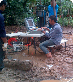
Onshore geotechnical drilling obtains soil and rock samples, delivering critical subsurface data for safe construction and foundation design.

Offshore geotechnical drilling collects subsurface soil and rock samples, providing essential engineering data for foundation and marine structure design.
.jpeg)
CPTu test measures cone resistance, sleeve friction, and pore pressure, providing detailed soil stratigraphy and geotechnical parameters.
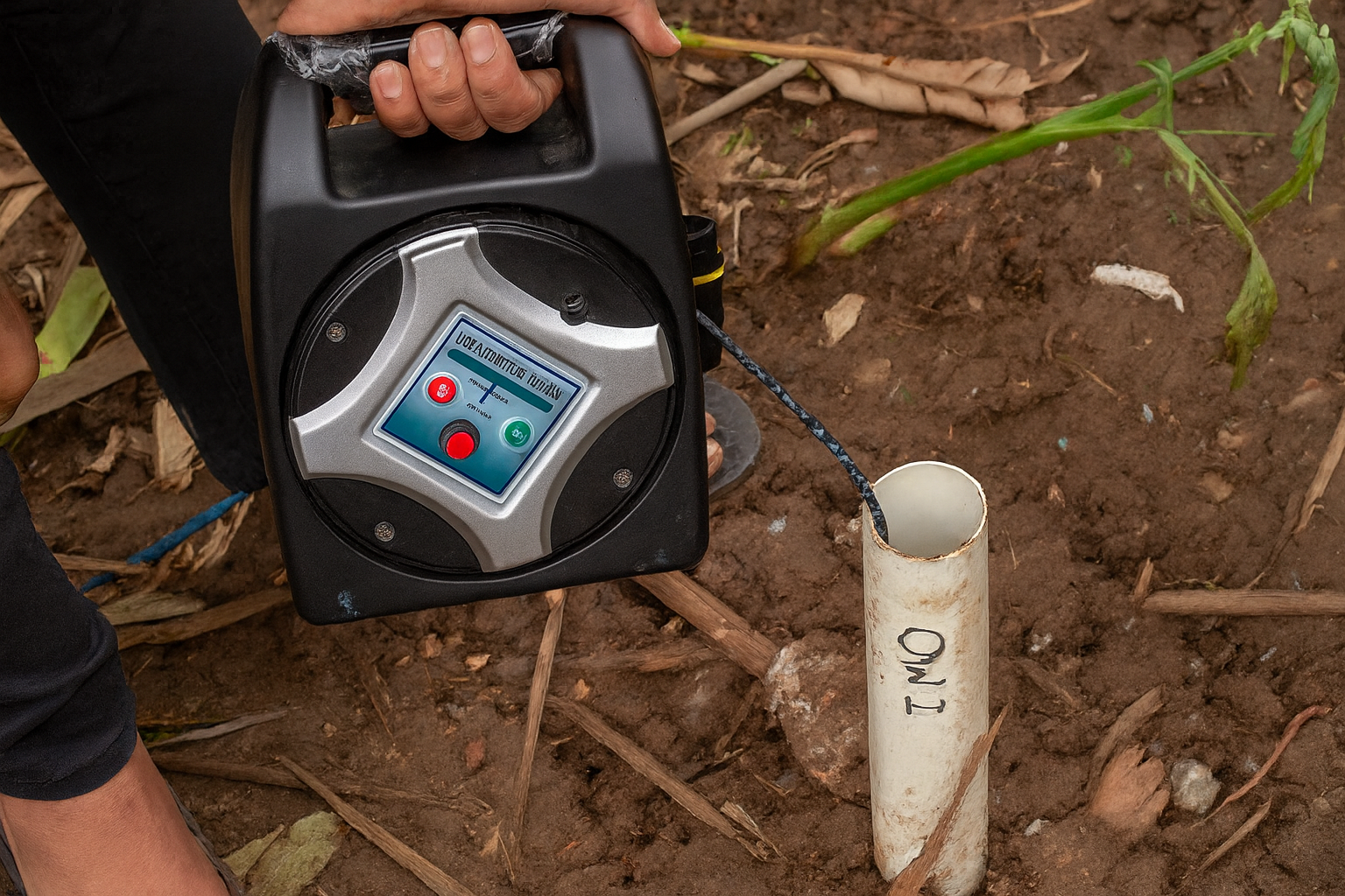
Dip Meter measures groundwater depth in piezometer wells using probe and cable, monitoring water table fluctuations accurately.
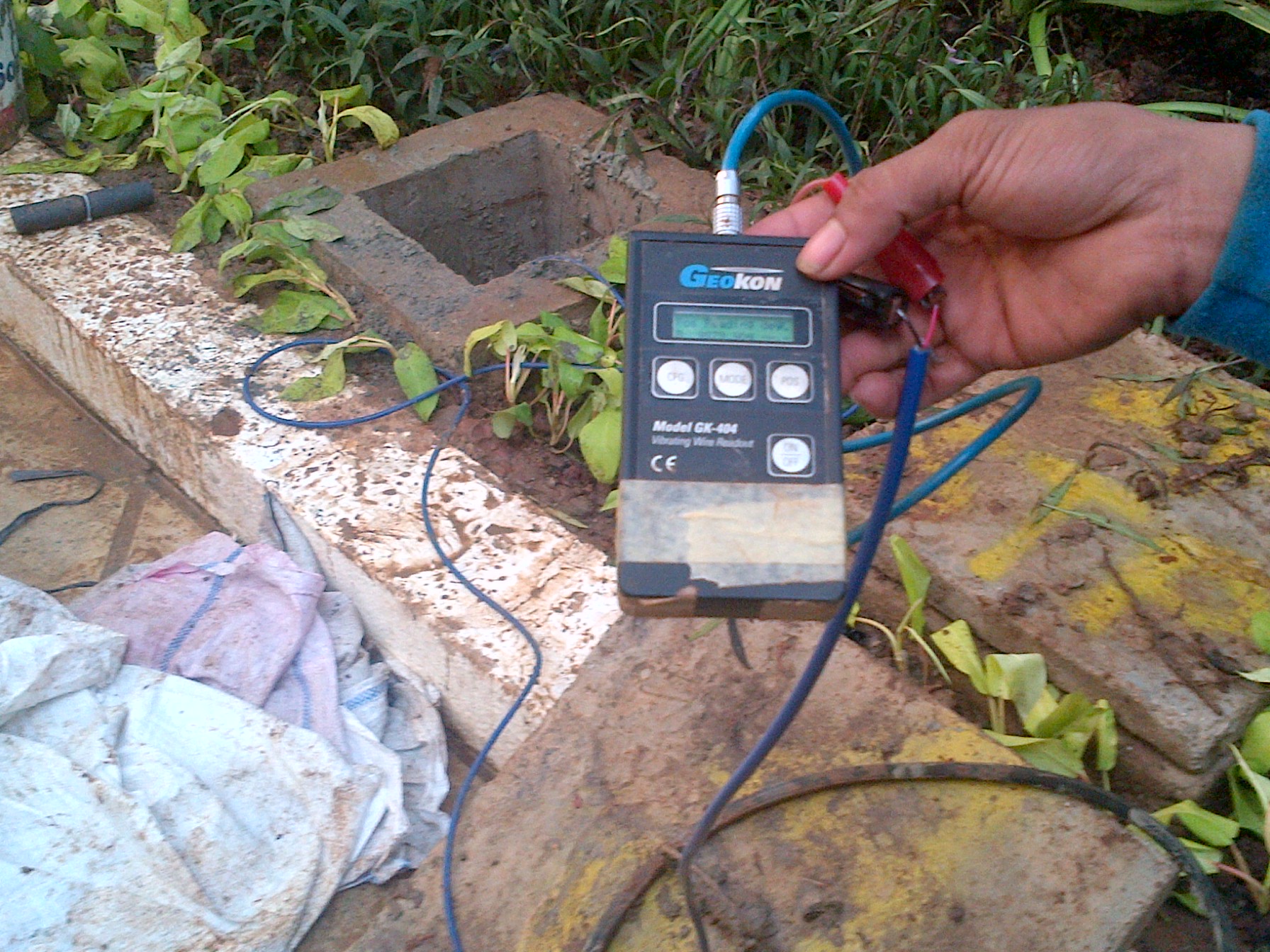
Vibrating Piezometer measures pore water pressure in soil or rock, monitoring groundwater changes and ensuring geotechnical structure stability.
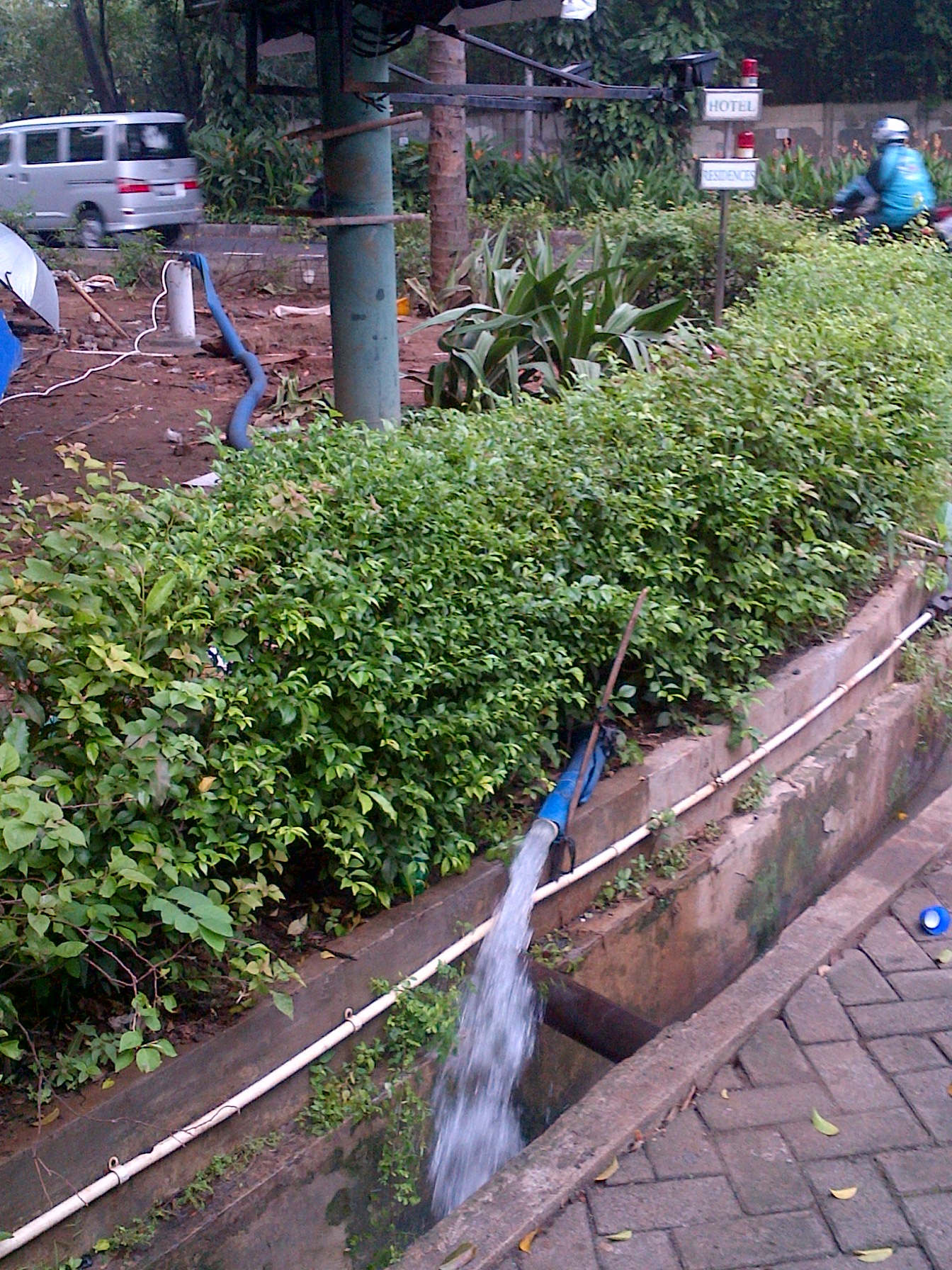
Pumping test evaluates aquifer properties by extracting groundwater, analyzing drawdown, and recovery to determine yield and hydraulic parameters.
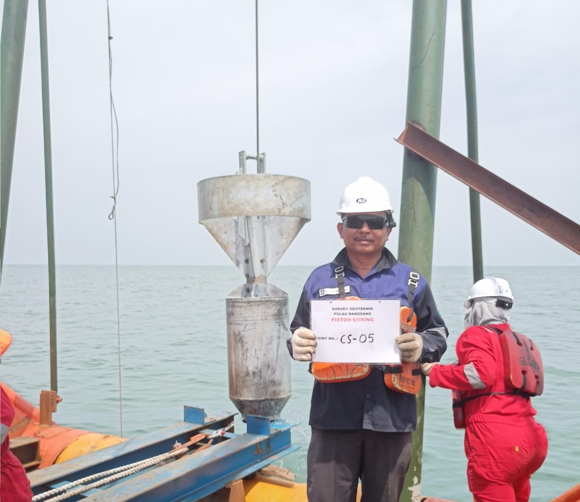
Piston Core Survey collects long, undisturbed sediment samples from seabed, providing stratigraphic, geotechnical, and environmental data for analysis.

“Lorem ipsum dolor sit amet, consectetur adipiscing elit, sed do eiusmod tempor incididunt ut labore et dolore magna aliqua. Ut enim ad minim veniam, quis nostrud exercitation ullamco laboris nisi ut aliquip ex ea commodo consequat. Duis aute irure dolor in reprehenderit in voluptate velit esse cillum dolore eu fugiat nulla pariatur.”

“Lorem ipsum dolor sit amet, consectetur adipiscing elit, sed do eiusmod tempor incididunt ut labore et dolore magna aliqua. Ut enim ad minim veniam, quis nostrud exercitation ullamco laboris nisi ut aliquip ex ea commodo consequat. Duis aute irure dolor in reprehenderit in voluptate velit esse cillum dolore eu fugiat nulla pariatur.”

“Lorem ipsum dolor sit amet, consectetur adipiscing elit, sed do eiusmod tempor incididunt ut labore et dolore magna aliqua. Ut enim ad minim veniam, quis nostrud exercitation ullamco laboris nisi ut aliquip ex ea commodo consequat. Duis aute irure dolor in reprehenderit in voluptate velit esse cillum dolore eu fugiat nulla pariatur.”

“Lorem ipsum dolor sit amet, consectetur adipiscing elit, sed do eiusmod tempor incididunt ut labore et dolore magna aliqua. Ut enim ad minim veniam, quis nostrud exercitation ullamco laboris nisi ut aliquip ex ea commodo consequat. Duis aute irure dolor in reprehenderit in voluptate velit esse cillum dolore eu fugiat nulla pariatur.”

Feasibility Study and Planning evaluates technical, economic, and environmental aspects, ensuring project viability, risk management, and sustainable implementation.

Environmental Impact Assessment systematically evaluates potential environmental consequences of proposed projects, ensuring compliance, sustainability, and mitigation strategies to protect ecosystems, resources, and communities while supporting responsible development.

Infrastructure Planning strategically designs and organizes transportation, utilities, and facilities, ensuring sustainable development, efficient resource allocation, improved connectivity, and long-term resilience for communities and economic growth.
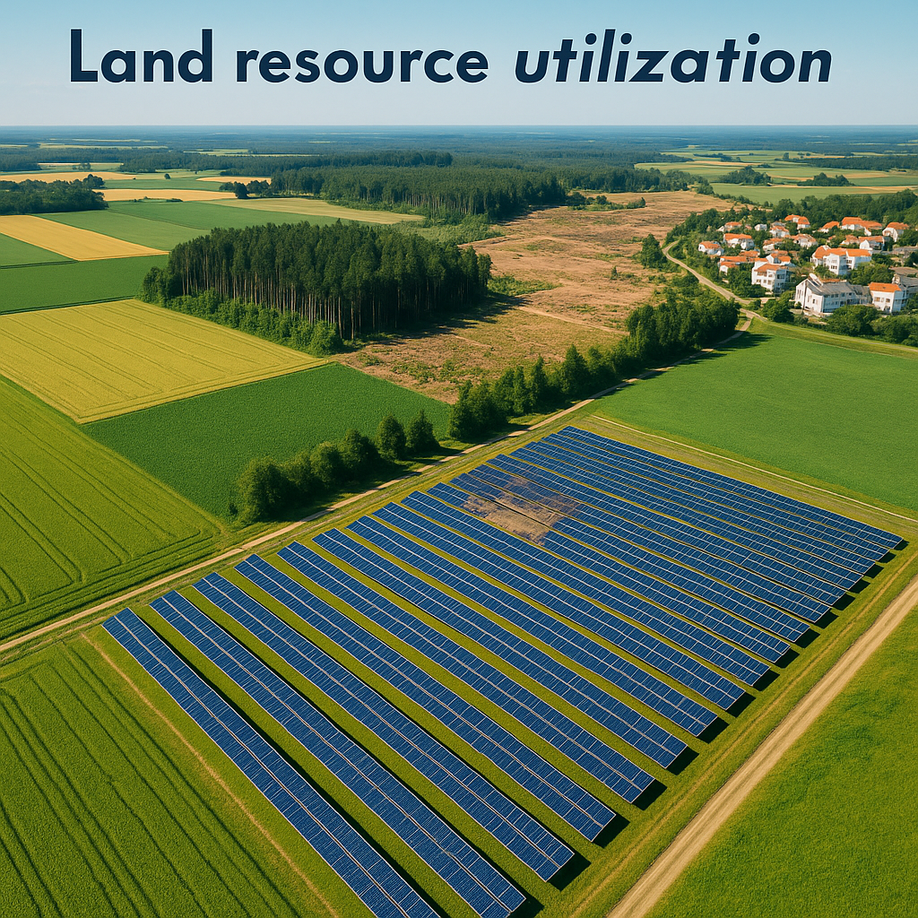
Land resource utilization involves managing land for agriculture, forestry, energy, urban development, and conservation to balance growth with sustainability.

Monitoring and Evaluation of Land Utilization and Infrastructure Development ensures sustainable growth, assessing effectiveness, impacts, compliance, and optimizing resource allocation for future planning.

Planning services for infrastructure systems integrate design, mapping, and strategy, ensuring sustainable development, efficient resource allocation, and resilient connectivity for communities.

Spatial Planning (RTRW/RTRK) organizes land use and zoning, balancing urban growth, environmental protection, infrastructure development, and sustainable resource management to ensure equitable, efficient, and resilient regional development.
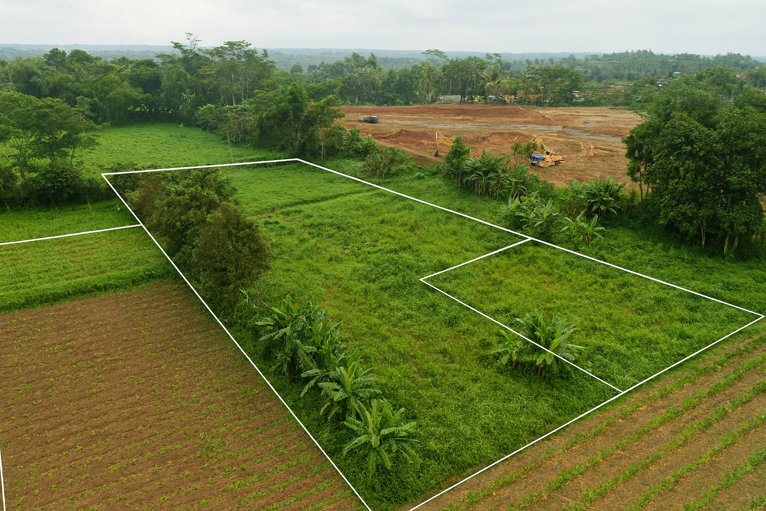
Land Boundary Determination defines property limits using surveys, cadastral maps, and geospatial techniques, ensuring legal clarity, ownership security, and conflict-free land management.

Power Plant Engineering Design develops detailed technical plans for energy generation systems, integrating mechanical, electrical, civil, and environmental aspects to ensure safe, efficient, sustainable, and cost-effective power production.
Fill out the form to connect with our experts and explore the best solutions for your project or business

